A severe cyclone named “Asani” neared the east coast, packing gale-force winds up to 105 kmph, amid indication of gradual weakening on Tuesday, the 10th of May, said the India Meteorological Department (IMD.)
The cyclone, which was moving at a speed of 25 kmph on Monday, has slowed down to 5 kmph as it lays centered around 300 km southeast of Kakinada in Andhra Pradesh and 510 km south-southwest of Gopalpur in Odisha. The system is expected to recurve on Tuesday night and move parallel to the coast in the north-northeast direction.
The Bhubaneswar Regional Meteorological Centre Director Mr. H.R. Biswas said, “The severe cyclonic storm has already started losing steam and it will further weaken into a cyclonic storm during the next 24 hours as it nears the coast and makes the recurve.”
He said the gale-force wind speed will decline to 80-90 kmph by Tuesday night and to 60-70 kmph by Wednesday evening. The MeT Department has warned fishermen against venturing into deep sea till Thursday, as Odisha braced for heavy rain in the coastal areas. Rainfall was recorded in Ganjam, Puri and Khurda on Tuesday morning.
The weatherman has predicted heavy rain in parts of coastal Odisha from the 10th of May and the 12th of May. The Special Relief Commissioner P K Jena said local authorities have been put on alert to face heavy rain and water-logging and asked to undertake evacuation of people from 15 blocks in four coastal districts.
The Ganjam district administration has closed all beaches including Gopalpur for visitors for two days.
Sea condition is likely to remain very high on Tuesday, and become very rough on May 12 before improving thereafter.
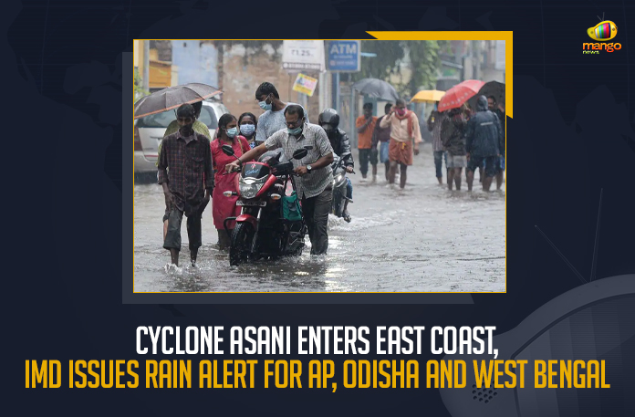
Under the influence of the cyclone, Odisha and West Bengal had received heavy to moderate rainfall on Monday.
Mango News Link
Telegram: https://t.me/mangonewsofficial
Google Play Store: https://bit.ly/2R4cbgN
Apple / iOS Store: https://apple.co/2xEYFJ
Subscribe to our email newsletter to get the latest posts delivered right to your email.
Comments